Before a thunder storm
Our second tutorial on “seeing” is about clouds. I love watching the skies, especially the beautiful clouds around us. I’ve taken numerous cloud photos as I’ve spotted striking displays, stopping my car in a parking lot or beside the road, running out to the parking lot at my studio, and quite often just standing in my back yard. My husband shares my appreciation of clouds and between the two of us, we have an impressive cloud reference photo collection.
There are many different types of clouds with many different types of appearances. Clouds are different with the times of year and weather conditions.
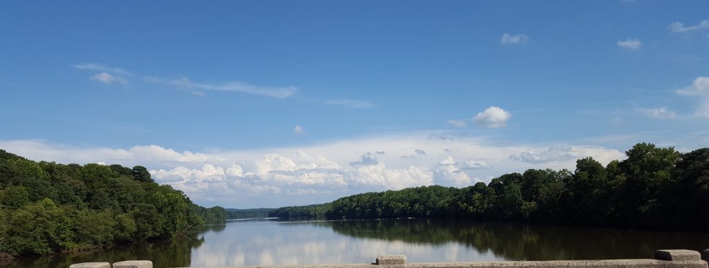
In the photo above notice the range of values that we see in the clouds. Clouds are not just one value or just white. The wispy clouds in the upper area are a medium light grey value. The middle layer of clouds have a wide range of values from dark grey to white, the lightest areas of this photo. The closest clouds have the darkest values ranging from medium dark grey to a dark blue grey.
The higher altitude layers are thin, wispy cirrus clouds composed of mostly ice crystals. Generally occurring in fair weather, cirrus clouds point in the direction of air movement at their elevation. The billowing lower altitude cumulus clouds, contain water droplets, can produce rain, sleet, or snow, and appear “puffy”. You see many layers in these clouds with shadows and lights depending on the direction of the sun.
Clouds can be many different colors depending on the sunlight and time of day. Storm clouds display striking dark greys. Sunny days present us with clean white fluffy clouds. Sunrises and sunsets with clouds can be glorious.
Go watch the skies. Really see the clouds, the values, the colors, the textures. Studying the details in nature not only helps us in our painting but gives us a greater appreciation of nature. Enjoy this most beautiful world around us.
Painting Clouds Video